HIKE UP TO INTI PUNKU AT OLLANTAYTAMBO
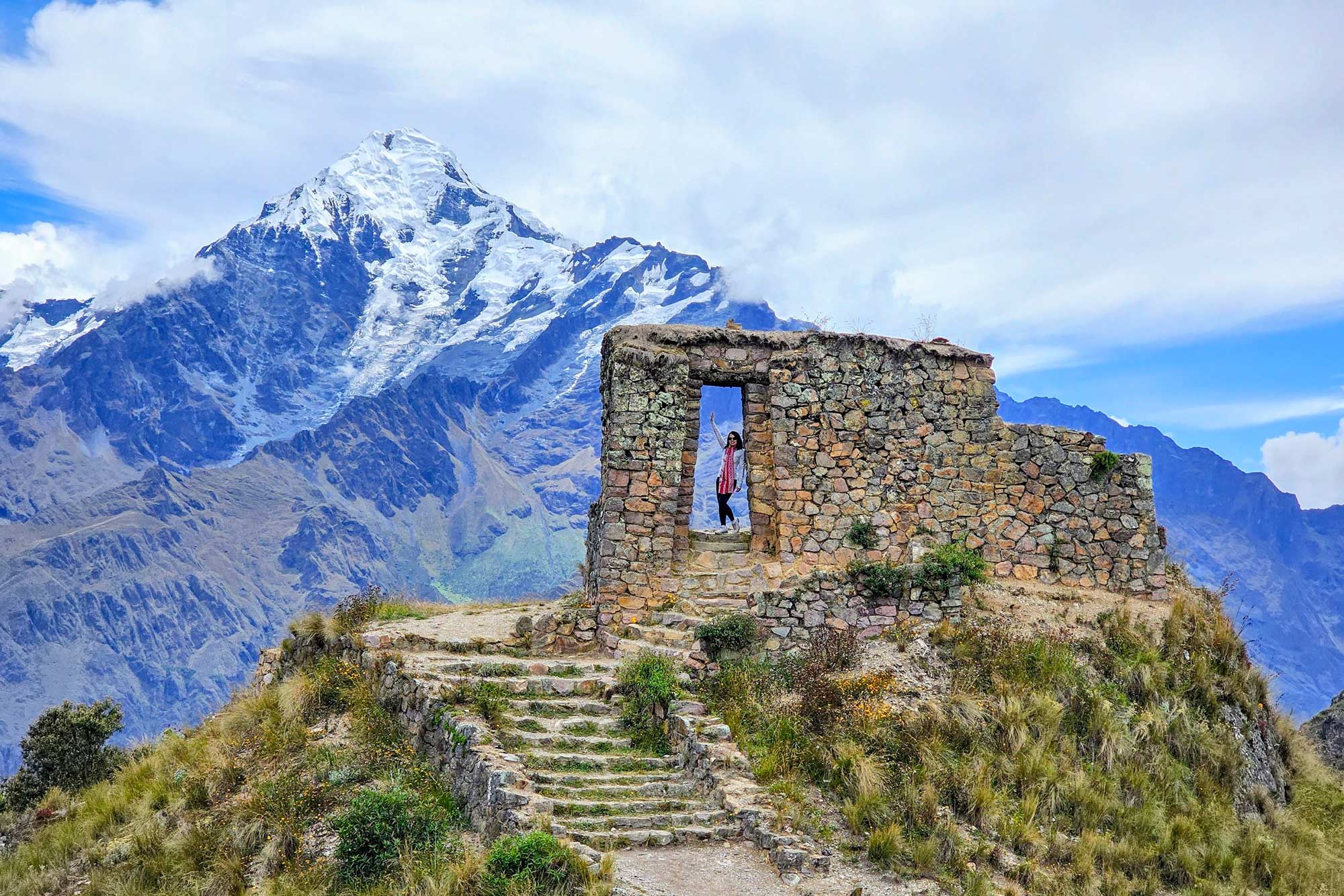
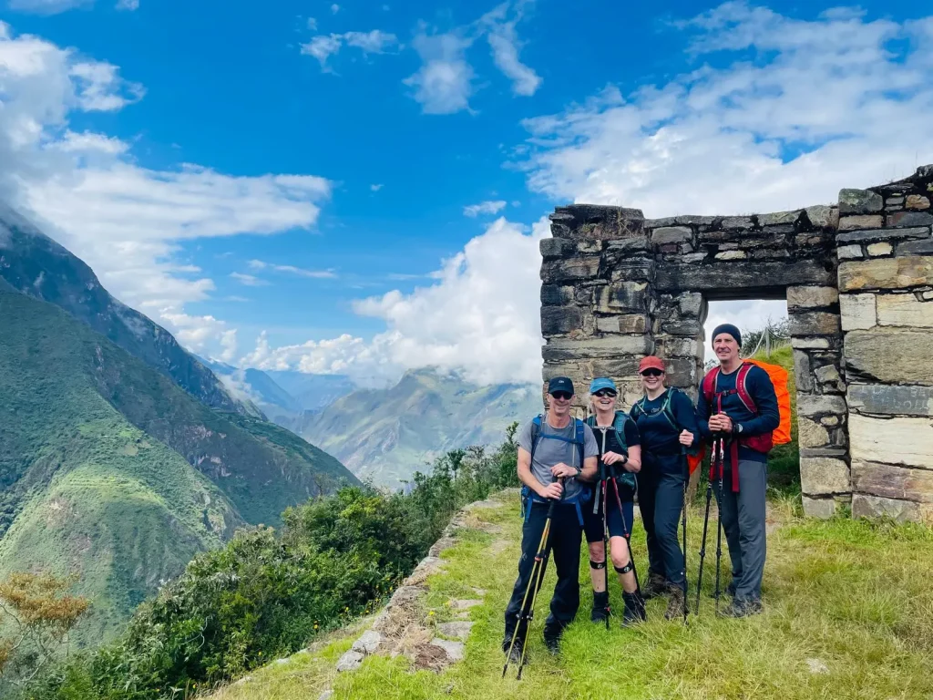
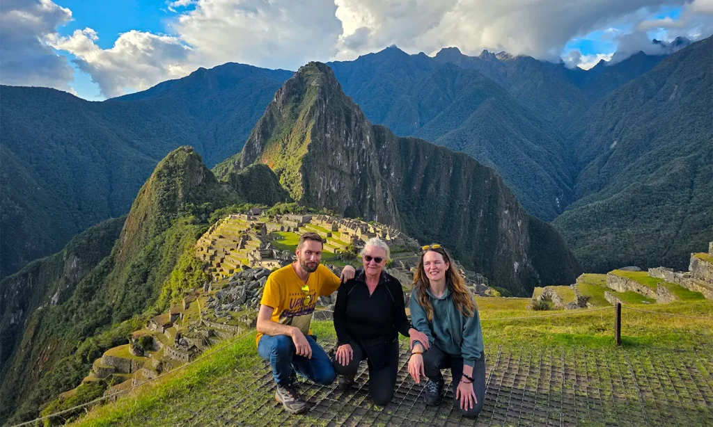
Everyone knows the famous Intipunku (Sun Gate) located on top of Machu Picchu. However, few visitors know that there is another Intipunku on top of one of the mountains that surrounds the town of Ollantaytambo. The photos that can be obtained from there, with the snowy Verónica in the background, are incredible, find out all the information of the hike up to Inti Punku ruins
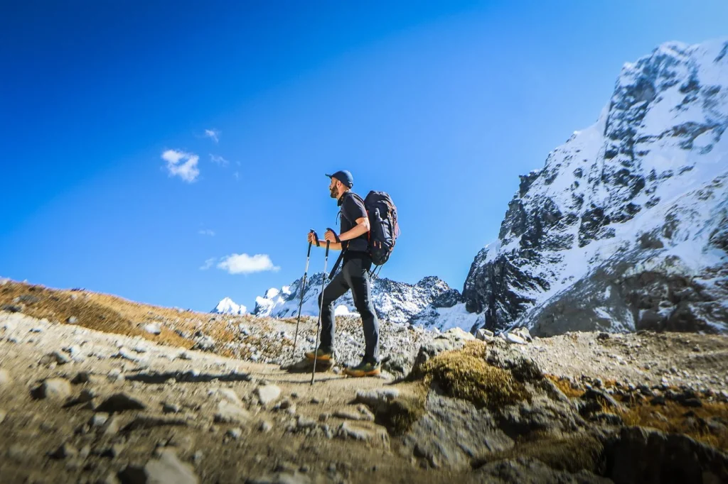
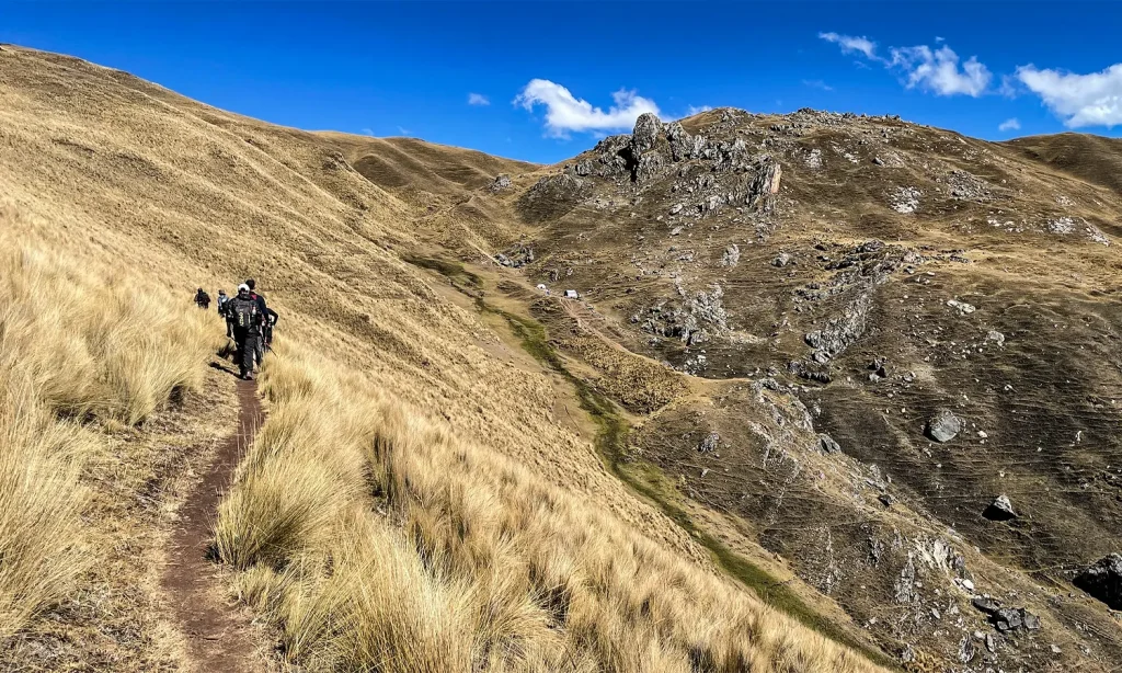
Hiking up to Inti Punku requires an arduous walk of approximately 3 kilometers uphill, its one of the most difficult day hikes in the Sacred Valley but gives you the most spectacular views and its really worth it.
What is Intipunku?
- The Intipunku is a construction made of stones as a center of worship to the Inca gods: the mountains, the sun, the stars, the moon and the earth.
- Its name comes from a Quechua word meaning ‘door of the sun’. During the mornings and especially during the summer solstices, the sun’s rays pass through this door, approximately 2.20 meters high and 1 meter wide.
- As in the famous Intipunku located in Machu Picchu, there the Incas performed religious ceremonies of great importance. Through this door you have a spectacular view of the snowy Verónica, also called Wakay Willka: sacred tears.
Today the Intipunku of Ollantaytambo is a tourist attraction rarely visited by tourists because it is not included in a traditional tour. You can only go there on your own. Admission is free. Of course, you must take an arduous walk of 3 kilometers to get there.
Location
- Intipunku is on top of a mountain in the Sacred Valley of the Incas, 3,900 meters above sea level.
- It belongs to the district of Ollantaytambo (province of Urubamba), at the top of the community of Cachiccata.
- Geographically it lies above the banks of the Vilcanota River. At the top stand out the views of the snowy Veronica and Wakaywillca
What t osee and expect during the hike to Inti Punku?
1.- The Cachiccata ramp and Quarry stone
The obvious ramp that goes up to the Ollantaytambo archeological site is where they dragged the giant stones still standing at the top of the site.
This place was dedicated to the extraction and carved the stones that were used for the construction of Ollantaytambo and many surrounding enclosures. This place is located to nine miles from the Inca town of Ollantaytambo
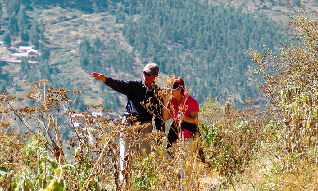
2.- Inti Punku’s spectacular views
What you can see from Inti Punku is the glacier-capped mountains that line the north side of the Sacred Valley, with Wakay Willka seemingly close enough to touch. As with many places in Peru, there are overlapping names of Spanish, Inca and pre-Inca origin. Also, Quechua names usually have more than one correct spelling. Wakay, or waqay, are tears in Quechua and willka or wilka means sacred. This is likely in reference to the importance of the glacial melt from the peak’s glaciers, which irrigated fields and crops around Ollantaytambo.
3.- Chullpas (Burial Site) along the hike up to Inti Punku
Chullpas, round burial sites, were common in the north, but many of the people that the Inca conscripted to build Ollantaytambo were from what is now northern Peru.
4.- Choquetakarpu
These are the only buildings along the trail, and were possibly an administrative center for managing the nearby quarry.
5.- Apachetas
Apachetas are small stacks of rocks, which Peruvians still make to show respect for the mountains and as places to leave offerings like coca leaves and flowers.
6.- Spanish mill stone
The Spanish used the same quarry that the Inca had used, making things like this giant mill stone for grinding corn or wheat.
Check the elevation
The elevation gain is what makes this hike so hard. It’s 3,870 feet (1,180m), from Ollantaytambo at 9,160 feet (2,792m) up to 13,035 (3,972).
Best place to start?
Most people start in Ollantaytambo, at a spot called the Inca Bridge. It’s about 10.2 miles (16.4km) round trip. When I hiked this, our van took us to Cachiccata and we hiked only 8.6 miles round trip (13.8km).
Rainy season vs. Dry season
During the rainy season the peaks you can see from Inti Punku are often covered with clouds, but the valley is green. If you hike in the dry season, you can usually see the chain of glacier topped Andean peaks, but the hills are brown with dry grass.
Some recommendations
- During your visit to the Intipunku, take comfortable and resistant shoes with you . Also comfortable and sports clothing as well as a hat, sunscreen, mosquito repellent, poncho in case of rain, fruits, snacks, rehydrating drinks and everything in a suitable backpack.
- Take cash with you as the various tourist services do not accept credit or debit cards. Transportation services and restaurants only accept money in Peruvian soles, not dollars or euros.
Frequently asked questions about the Intipunku of Ollantaytambo
- What does intipunku mean?
Intipunku is a Quechua word that means ‘door of the sun’.
- Where is the Intipunku?
The Intipunku is located on top of a mountain that belongs to the Cachiccata community in Ollantaytambo (61 kilometers from the city of Cusco).
- Is the walk to the Intipunku of Ollantaytambo difficult?
Yes. The walk is uphill for a steep section. It takes between 2 to 3 hours depending on the physical resistance of the person.
- How much does it cost to visit the Intipunku of Ollantaytambo?
There are no entrance tickets to the Intipunku of Ollantaytambo. Admission is free for all tourists.
- What is the difference between the Intipunku of Ollantaytambo and Machu Picchu?
The Intipunku of Ollantaytambo has incredible views of the Sacred Valley of the Incas while the Intipunku of Machu Picchu offers panoramic views of the beautiful Inca citadel.
- How high is the Intipunku of Ollantaytambo?
The Intipunku is at 3,900 meters above sea level.
- How is the weather in the Intipunku?
The climate in the Intipunku is cold temperate with strong winds. The temperature varies from 0ºC. (at night) up to 16ºC. (on day). The rains can occur at any time, especially from January to March.
- What car to take to visit the Intipunku?
The first step is to travel from Cusco to Ollantaytambo. To do this, you must take the minivans that leave from Pavitos street. Then take a taxi or motorcycle taxi to the community of Cachiccata. There the walk begins.
- Is it dangerous to visit the Intipunku?
No. The route is hard, difficult but not dangerous. It is recommended to follow the indicated paths with the appropriate footwear and a travel backpack with snacks, drinks and whatever you consider necessary.
- How to see the sunrise from the Intipunku of Ollantaytambo?
Many tourists seek to see the sunrise from the Intipunku, an incredible natural spectacle. For this, it is necessary to leave Cusco at around 2 am and start the trek to Intipunku at 4 am. You will be able to see the sunrise at approximately 6 am.
The information Hike Up to Inti Punku Ruins at Ollantaytambo has been updated on 2025